
QazaqSu Atlas: Kazakhstan Water Atlas
Problem
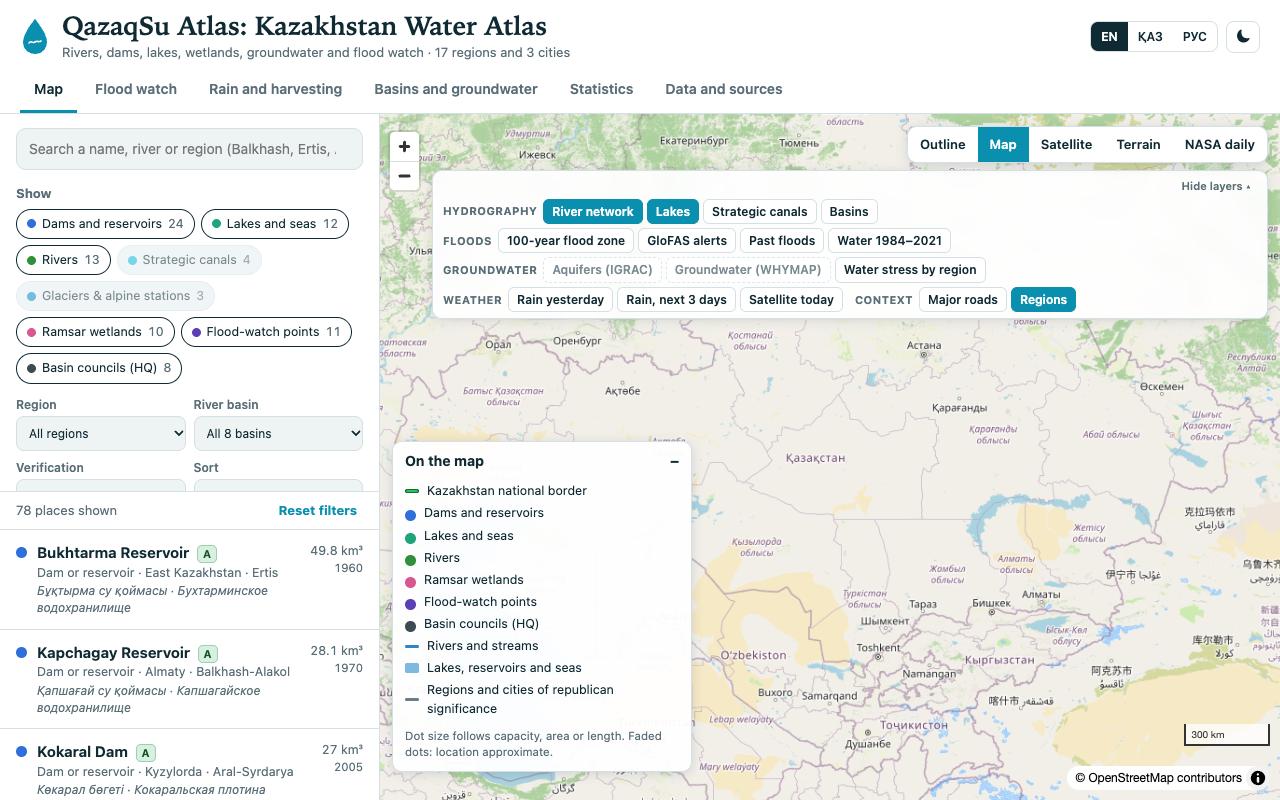
Kazakhstan’s surface-water resources span 106 km³ with 44.3% arriving through transboundary rivers. That vital hydrological scale is hard to comprehend when split across separate ministries, reports, and desktop archives.
Approach
Architected a lightweight, multilingual water atlas using Next.js 14, MapLibre GL JS, and serverless PMTiles. Features 16 interactive data layers including rivers, dams, reservoirs, lakes, Ramsar wetlands, basin councils, and real-time flood monitoring powered by the Open-Meteo Flood API and NASA GIBS satellite imagery.
Tech Stack
Results
Unifies 78 major water infrastructure locations and ecosystems with verification grading and full trilingual accessibility in English, Kazakh, and Russian.
What I Learned
Engineered performant client-side vector tile styling with HydroSHEDS PMTiles; integrated real-time hydrometeorological endpoints with localized basin geometries.
Enjoyed this piece?
Leave a reaction to let the author know what resonated with you.